Weather Reports for Insurance Adjusters
StormAuditor gives independent, field, desk, and catastrophe adjusters the storm history at an insured address before the inspection, so the reported date of loss can be compared with the storm dates on record there.

Check the reported date of loss in minutes
The Free Report Snapshot gives a first look at any address: YES or NO for estimated wind of 45 mph or more and estimated hail of 0.75 in. or larger in the last five years.
The Weather Report then lists every storm date at the property with an estimated gust of 40 mph or more or estimated hail of 0.50 in. or larger. If the reported date is there, you see its estimated values; if another date shows larger hail or stronger wind, you see that too. The date-of-loss research guide walks through the full process.
Related guide: What adjusters look for in weather data for a roof claim covers each check an adjuster runs on a storm date, from station distance to the timing of the warning.
A deployment day, step by step
Morning queue
Run a Free Report Snapshot on each assignment to see which addresses show estimated wind of 45 mph or more or estimated hail of 0.75 in. or larger.
2 a day free · unlimited on Pro and higher
Before you drive
Pull the Weather Report so you arrive knowing the storm dates and estimated hail sizes at the property.
$2.99 single · Pro 5/day · Pro+ unlimited
Across the CAT zone
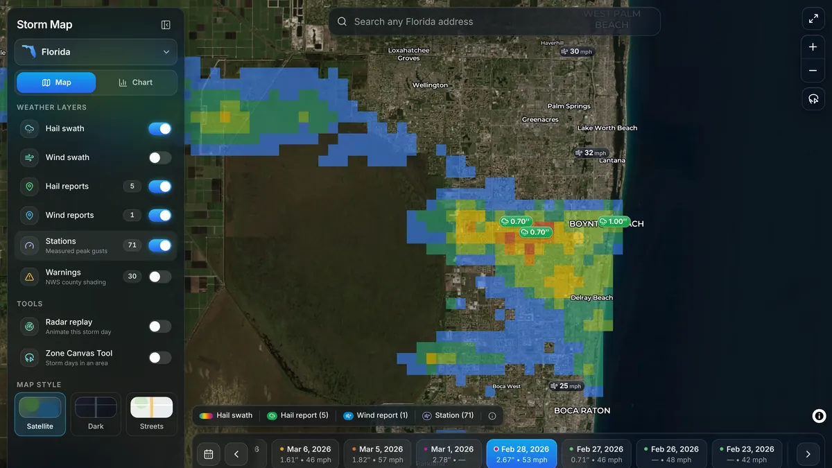
The hail map, wind map, and Storm Map Dashboard show each storm day's full statewide footprint, with storm reports and NWS warnings on one map.
Pro+
Back at the desk
Attach the Weather Report PDF to the file; order the Audit Report when a disputed date needs the nearby instrument evidence and the arithmetic.
Audit Report: $2.99 single · Pro 1/mo · Pro+ unlimited
Start with a free look at any address. Run a Free Report Snapshot · Create a free account
Deployment questions
How can an adjuster check a reported date of loss?
Run a Weather Report at the insured address. It lists every date since October 2021 with an estimated gust of 40 mph or more or estimated hail of 0.50 in. or larger at the property, with each date's values, so the reported date can be compared with the other storm dates on record there.
Does it work in a state I'm deployed to?
Pro+ ($9.99/mo) lets you switch to any state, and a single $2.99 Weather Report needs no account — the checkout page confirms coverage for the address before payment.
What data sources are behind the estimates?
NOAA MRMS MESH radar-estimated hail, the NWS analysis of record (URMA) and HRRR for wind, FAA/NWS ASOS/AWOS airport station observations, and NWS Local Storm Reports — all public government weather records, under published methodologies.
StormAuditor for other professionals
Roofing Contractors · Public Adjusters · Claim Attorneys · Restoration & Exterior · Teams & Firms · Storm data for professionals · For homeowners