Weather Research for Public Adjusters & Claims Professionals
Date of loss identification, per-address storm history, and warning records — organized from the public NOAA record under a published methodology.

Compare candidate dates of loss
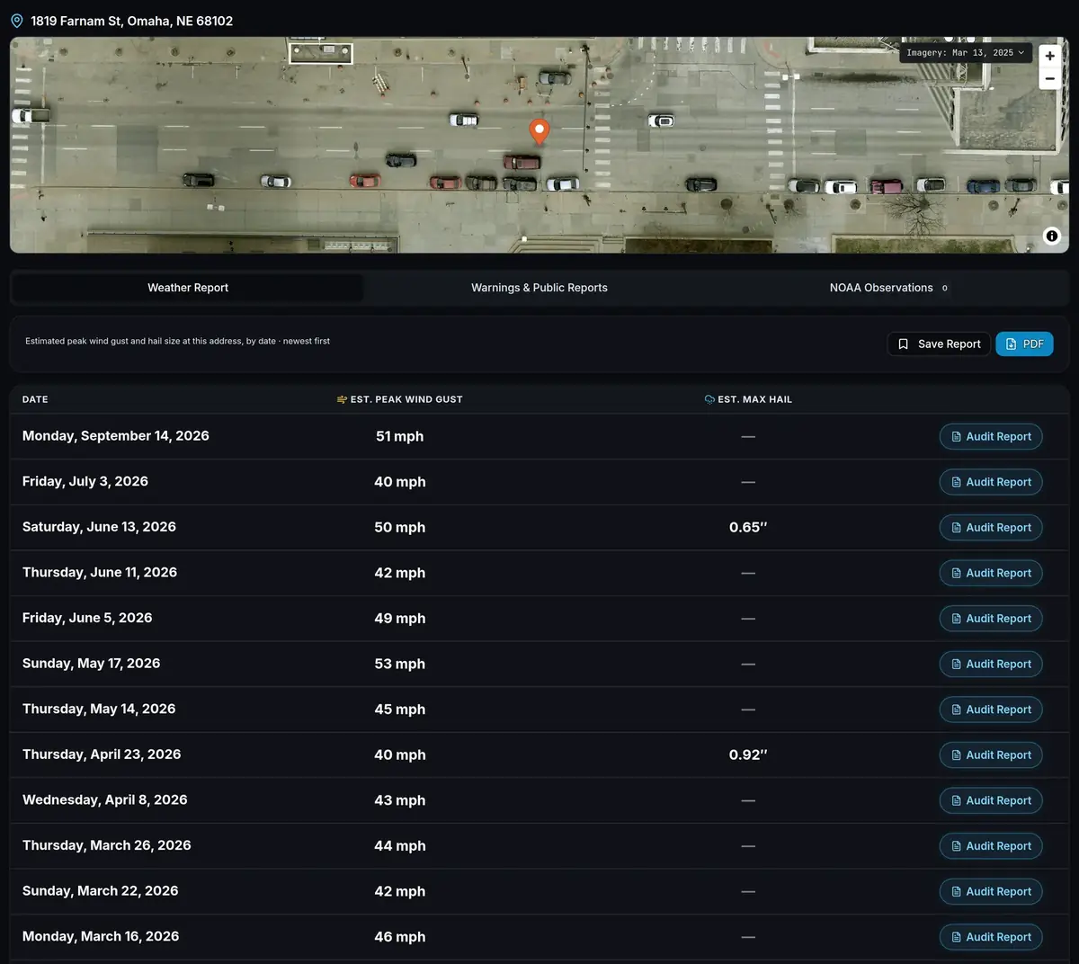
Claims often arrive with an uncertain date of loss — the policyholder remembers "a hailstorm last spring," and the carrier needs a date. The date-of-loss workflow starts with the Date-of-Loss Database, which ranks candidate storm dates for your state from deduplicated NWS warnings, observed storm reports, and station measurements, and the Weather Report lists which of those dates produced an estimated gust of 40 mph or more or estimated hail of 0.50 in. or larger at the insured address.
When more than one storm falls inside the policy period, each date appears with its estimated peak gust and, where 0.50 in. or larger, its estimated hail size, so the dates can be compared side by side.
What each tool does for a date-of-loss file
Date-of-Loss Database
The candidate dates for your state, ranked, before you ever pull an address.
Top 5 free with an account · full list on Pro
Weather Report
Every qualifying storm date at the insured address since October 2021, as a PDF for the claim file.
$2.99 single · Pro 5/day · Pro+ unlimited
Audit Report
For one date, the Audit Report lists the instruments that carry the most weight, their distances from the property and measured values, and the arithmetic behind the estimate.
$2.99 single · Pro 1/mo · Pro+ unlimited
Statewide maps
The hail map, wind map, and county impact heatmap show how widespread the storm was across the state and its counties.
Maps Pro+ · heatmap free with an account
Sources anyone can follow
The wind methodology and hail methodology are published in full, the data sources page links every layer to its public source archive, and the Audit Report for a date names each leading instrument behind that date's value.
Rank the candidate dates first. Open the Date-of-Loss Database · Create a free account
Date-of-loss questions
How do public adjusters find the date of loss?
Start with the Date-of-Loss Database to rank candidate storm dates for the state, then run a Weather Report at the insured address to see which dates reached the property. The Audit Report then documents any one of those dates in detail.
What if the date the policyholder remembers isn't on the list?
The Weather Report lists every date on which the estimated gust reached 40 mph or the estimated hail reached 0.50 in. at the property. If a remembered date from October 2021 onward is missing, the estimated gust stayed below 40 mph and the estimated hail below 0.50 in. at the property that day — check the Date-of-Loss Database for the other storm dates in the same period.
How many reports can I run a day?
Pro includes 5 Weather Reports a day; Pro+ and Organization accounts are unlimited. Single reports are $2.99 each with no subscription.
StormAuditor for other professionals
Roofing Contractors · Insurance Adjusters · Claim Attorneys · Restoration & Exterior · Teams & Firms · Storm data for professionals · For homeowners